Good morning, and I apologize for the long delay in posting these.
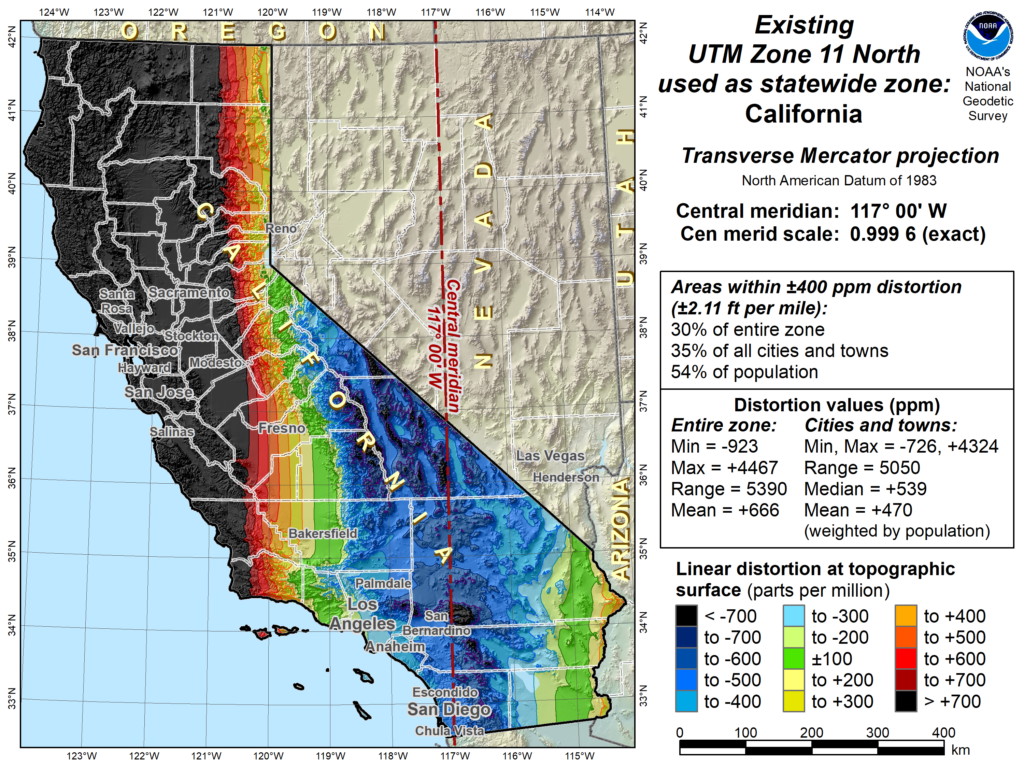
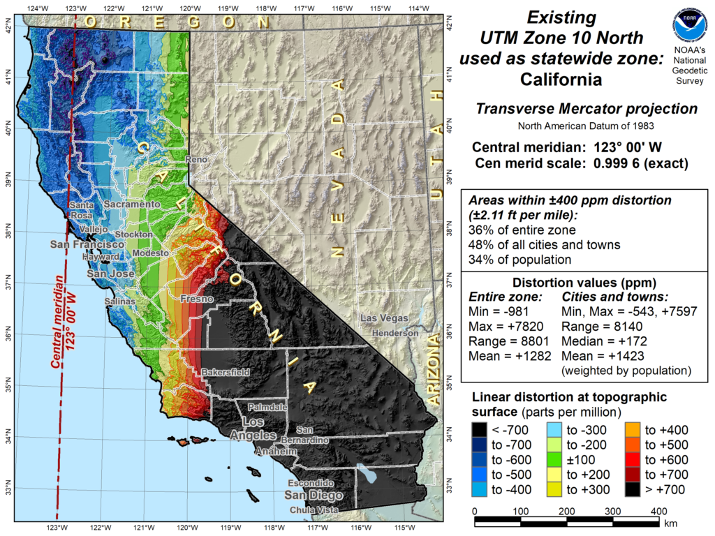
Attached are PDF versions of the presentation materials from both Cy Smith, with the State of Oregon on their Geographic Information Council and Scott Martin with Caltrans on the National Geodetic Survey (NGS). I’ve also included some of the graphics prepared by NGS staff showing distortion by projection.
Cy Smith provided a very educational overview of the Oregon State Geographic Information Council, how it was founded, organized, and how it is operating.
Scott Martin provided an update on the upcoming update to the national reference system, and pointed out that we have an opportunity as a Council to weigh in on decisions being made that will impact the state. We proposed the establishment of a new working group to review and report on SPCS2022 with an eye towards providing feedback to the National Geodetic Survey prior to the end of the year. This new working group will need a chair as well as members. Please contact me (Nathaniel Roth, calgischair@cgia.org) if you are interested in either serving as leadership or a member.
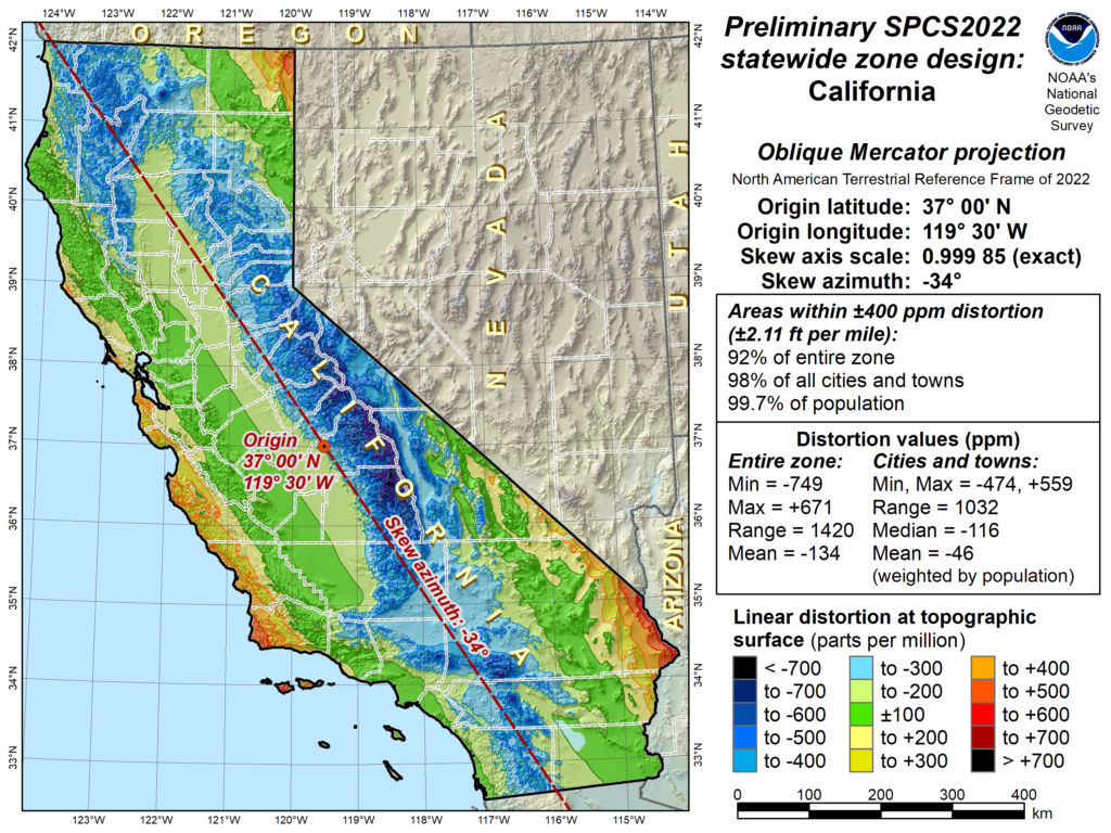
Some distortion maps for UTM Zone 11N and 10N. Prepared by Michael Dennis, NGS.
Our California(Teale) Albers cannot be quantified in the same fashion.
“Teale-Albers distortion. A distortion map cannot be made for the Teale-Albers, because it is an equal-area projection and so distortion varies with direction (i.e., there is not a unique value at a point). What I can do, though, is prepare a table giving the meridian and parallel distortion at various cities in CA, along with (constant) distortion values for UTM zones 10 and 11, as well as the preliminary statewide OM projection. I don’t know why an Albers was selected for CA in the first place, since it is a conical projection. A cylindrical projection seems a better choice, given the greater north-south (~1000 km) than east-west (~900 km) length of CA (especially the much narrower oblique width of ~500 km, which definitely favors an oblique cylindrical projection). It is also important to note that SPCS2022 zones will be limited to the LCC, TM, and OM projections (which are all conformal), and NGS will create a statewide zone for every state. Of course, a state can use whatever they want for their own purposes, but if it’s not one of those three it cannot be part of SPCS2022. “ Michael Dennis, NGS