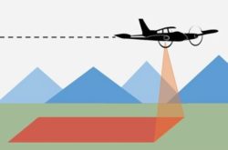
Elevation Workgroup

August 7 Webinar for 3D National Topography Model Data Collaboration Announcement 

image representing land topography and a waterway

The USGS National Geospatial Program collaborates with a wide range of stakeholders to share costs of topographic data acquisition in support of collective mission and business requirements. The Fiscal Year (FY) 2025 3D National Topography Model (3DNTM) Data Collaboration Announcement…
Read more

USGS Data Collaboration Portal for Elevation & Hydrography Now Open

image representing land topography and a waterway

The 3D National Topography Model (3DNTM) Data Collaboration Announcement (DCA) for Fiscal Year 2024 opens on September 7, 2023.  The 3DNTM is a new initiative that updates, improves, and integrates USGS elevation and hydrography data to support the most demanding…
Read more

12/8/22 Council Meeting Highlights

Snow collects on trees after the Sierra Nevada foothills woke up to snow that fell overnight on February 21, 2019. Kelly M. Grow / California Department of Water Resources,

The notes from the December 8 CGIA Community Council meeting are now available at https://cgia.org/cagiscouncil/wp-content/uploads/2022/12/CGIA-Community-Council-12-08-2022-Meeting-Notes.pdf There was lively discussion on a lawsuit involving a California GIS practitioner and the California Board for Professional Engineers, Land Surveyors, and Geologists over the…
Read more

Public 3DEP Project Collector Tool – Invitation to submit FY21 Public 3DEP Areas of Interests (AOIs) to Seasketch

Dear colleagues, The 3D Elevation Program (3DEP) continues to utilize the NOAA sponsored Seasketch:  U.S. Federal Mapping Coordination – A Demonstration Site for Federal Mapping Data Acquisition Coordination site for planning, coordinating partnerships, and tracking elevation data acquisition projects.  The system supports the maintenance…
Read more