Projects

August 7 Webinar for 3D National Topography Model Data Collaboration Announcement 
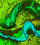
image representing land topography and a waterway

The USGS National Geospatial Program collaborates with a wide range of stakeholders to share costs of topographic data acquisition in support of collective mission and business requirements. The Fiscal Year (FY) 2025 3D National Topography Model (3DNTM) Data Collaboration Announcement…
Read more

USGS launches new crowd source opportunity for CA map updates

A new challenge has been launched. It focuses on city halls in California and Nevada. See the link below for details. https://www.usgs.gov/core-science-systems/ngp/tnm-corps/mapping-challenges?qt-science_support_page_related_con=3#qt-science_support_page_related_con Please don’t forget that other US Topo map features can also be updated through the National Map Corps…
Read more