Author Archive: janeschaferkramer

Geographic Data Specialist in the California Department of Water Resources since 2008. Presently serving as the Technical Lead for the California National Hydrography Stewardship Program. Board member of Northern California Chapter of URISA (Chapter President for 2016). GIS Certificate from American River College, 2009
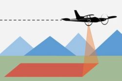
August 7 Webinar for 3D National Topography Model Data Collaboration Announcement 

image representing land topography and a waterway

The USGS National Geospatial Program collaborates with a wide range of stakeholders to share costs of topographic data acquisition in support of collective mission and business requirements. The Fiscal Year (FY) 2025 3D National Topography Model (3DNTM) Data Collaboration Announcement…
Read more

Location, Enterprise Addressing, and Public Safety Conference Feb. 27-29

Together, URISA, NENA, and NSGIC are pleased to announce the third-annual Location, Enterprise Addressing, and Public Safety (LEAP) Conference taking place virtually on February 27-29, 2024. To celebrate their collaborative efforts, members of all three associations are eligible for discounted…
Read more

Notes from 9/14/2023 Meeting are Posted

The notes from the September 14 meeting of the CGIA Community Council may be read here https://cgia.org/cagiscouncil/wp-content/uploads/2023/10/CGIA-Community-Council-09-14-2023_Notes.pdf Included are slides from a terrific presentation on the CalOES Fire Integrated real-Time Intelligence System (FIRIS) Program. Please save-the-date for the next meeting,…
Read more