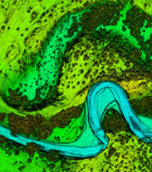
The USGS National Geospatial Program collaborates with a wide range of stakeholders to share costs of topographic data acquisition in support of collective mission and business requirements. The Fiscal Year (FY) 2025 3D National Topography Model (3DNTM) Data Collaboration Announcement (DCA) is scheduled for release in August 2024.
The DCA provides a mechanism for partnering with the USGS and other Federal Agencies to acquire high-quality 3D Elevation (LiDAR) or 3D Hydrography data to provide California and the Nation with high-resolution topographic products to support a broad array of applications.
USGS will host an instructional webinar on August 7, 2024 from 10:00 – 11:00 AM PDT to provide an overview of the application process, followed by a Q&A session. Registration is required.
For more information on 3DNTM and to register for the webinar, visit the DCA Portal: https://www.usgs.gov/3d-national-topography-model/data-collaboration-announcement-portal
Thank you, and please let me know if you have any questions or need further details.
– Drew Decker, National Map Liaison, ddecker@usgs.gov
Questions about California’s Hydrography Data Program may also be sent to Jane Schafer-Kramer, Hydrography Stewardship Lead, at nhd_stewardship@water.ca.gov