We received this message today (10/5/2020) From Tony Kimmet, National Imagery Leader, USDA:
FPAC-BC-GEO Branch has just received new NAIP 2020 Compressed County Mosaics (CCM) for all of California. I have checked and uploaded the new mosaics to the following links:
Main USDA Gateway Link: https://datagateway.nrcs.usda.gov/
All NAIP Mosaics: https://nrcs.app.box.com/v/naip
Direct to NAIP 2020 CCM’s: https://nrcs.app.box.com/v/naip/folder/123668170264
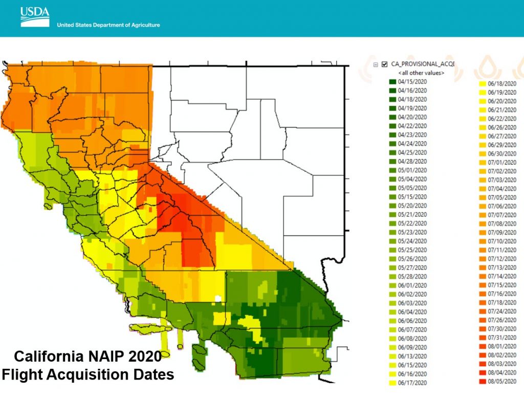
Because of the ongoing wildfires situation in California, I decided to sent out a special notice on this dataset to the GIS community. The CA NAIP Mosaics comprise of imagery collected from 4/15/2020 to 8/5/2020. The attached file “CA_NAIP_2020_ACQ_20201005” has a map of CA with imagery acquisition dates. This imagery may be the best pre-event imagery available currently.
Please note:
-That there a few areas not collected due to since they are military exclusion zones.
– You do not need a login to the Box site for downloading the CCM’s. Just hit download for the needed CCM’s. Wait about 10 seconds and Box will let you download the WinZip file to anywhere your wish.
I encourage you to send this notice out to everyone who would benefit from having this dataset.
Best Regards,
Tony Kimmet
National Imagery Leader
Geospatial Technology Coordination and Project Execution Section
Geospatial Enterprise Operations Branch (GEO)
Information Solutions Division
Farm Production and Conservation Business Center
U.S. Department of Agriculture
Fort Worth, TX
Cell: 817-821-2616
Email: tony.kimmet@usda.gov
Telework Days: Situational