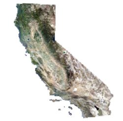
The USDA National Aerial Imagery Program – NAIP 2020 aerial imagery services for California are now available from the California Department of Fish and Wildlife. Also provided are services for earlier NAIP years and links to source data downloads and related files containing specific imagery dates:
https://wildlife.ca.gov/Data/GIS/Map-Services
The services are also discoverable through portals such as the California State Geoportal using searches such as:
https://gis.data.ca.gov/search?q=%222020%22&type=image%20service
Some of the NAIP services can also be viewed as basemaps within CDFW’s BIOS viewer that provides viewing and downloads for thousands of biogeographic datasets. To view the NAIP basemaps, open the BIOS Viewer, click the Basemaps button on the left side, scroll to the bottom of the pick list and choose one of interest.
https://wildlife.ca.gov/Data/BIOS
Information provided by Will Patterson, William.Patterson@wildlife.ca.gov
California Department of Fish and Wildlife, Biogeographic Data Branch, www.wildlife.ca.gov