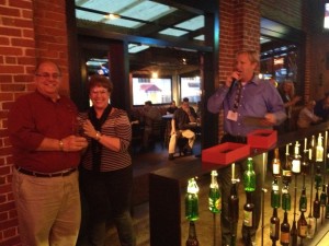
Exemplary Systems Award
Granted for outstanding application of GIS technology representing innovative, elegant, or creative techniques. The technology may be transparent to the end user and is not required to display map output.

San Diego Street Light Project
Winner: Ari Isaak, Evari GIS
Evari is the leader when it comes to implementing GIS technology solutions for streetlight conversion/retrofit projects. Streetlights present unique challenges due to their spread-out geographical nature and the large amounts of data points to manage. In situations where streetlights need to be mapped out and data collected, GIS is an invaluable tool. When it comes to streetlight conversions and retrofits, the use of mobile GIS technology is a game-changer.
Evari implemented this type of system on a $20 Million, multi-year project for the City of San Diego. In addition to handling the data management component, Evari set up a mobile GIS workflow that enables real-time editing of the streetlight database by work crews and a web-based mapping application accessible by Project Management. This means that project progress can be tracked and monitored in real-time and problems encountered in the field can be overcome in a timely fashion.
Besides the City of San Diego, Evari has continued to provide mobile and internet solutions for street light projects across the Country.
Nominated by: Lisa Caric Lee, Compass Rose GIS

Outstanding Internet Application Award
Granted to the outstanding integration of GIS and web technologies demonstrating excellence in aesthetic presentation, functionality, ease of use, and overall user experience.
City of Modesto GIS Site
Winner: Robert Beckler, City of Modesto
The City of Modesto uses GIS to manage and analyze City assets and other information. Several years ago the GIS Team planned, designed, and built a new GIS web site (www.modestogov.com/gis) to extend GIS functionality to City staff and the public. The GIS site was designed to be simple and intuitive to use, aesthetically pleasing, provide access to common data sets, provide user requested functionality, and be easy to maintain. The GIS web site has been a success and to this day continues to impress.
Users can search for locations by address, view property information, identify zoning, determine which Council District they live in, find parks, or view aerial photography. The site can also be used to locate businesses, view building permits issued on properties, determine whether a property is within the Enterprise Zone, display multiple other data sets, and more.
The GIS Team continues to enhance the usability, functionality, and appearance of our highly successful GIS web site. Future offerings will include further integration with other City applications, expanded reporting, and high quality printing capability.
Nominated by: Robert Becker
Â
Advancement of Collaboration Award
Granted for outstanding inter-organization collaborative efforts in GIS. This award is granted for exemplary results from interorganizational standards adoption, data sharing, application deployment, or work process integration.
California Public Safety Technology Modernization (PSTM)
Winner: PSTM GIS Team (CHP, CA DPR, CA DFW, Vestra Resources)
As part of the California Public Safety Technology Modernization (PSTM) project, a new computer aided dispatch (CAD) system is being implemented that the California Highway Patrol (CHP), the California Department of Parks and Recreation (CDPR), and the California Department of Fish and Wildlife (CDFW) will all begin using in spring 2014.
CDPR and CDFW have been sharing an older CAD system that lacks geospatial capability. The new CAD system is geospatial and its implementation effort marks the first time the 3 agencies have worked together on GIS-related dispatch needs.
This collaboration has been particularly challenging because of the geographically differing dispatch requirements of each agency.  There has been much work in compiling and creating the necessary geographic references specific to each agency. Park roads, trails, and entrance points were carefully assembled and digitized. Thousands of specific geographic reference points for each agency were compiled and assessed for redundancy or conflicting information. Agency dispatch boundaries were carefully reviewed, edited, and coordinated to use common line work between the 3 agencies wherever possible. Standard workflows have been established to process the data according to CAD requirements, and to add or correct the CAD geospatial data over time.
There may be no GIS application of higher importance than that of public safety. The PSTM GIS Team has been working very hard to ensure accurate and useful GIS data for California’s safety needs.
Nominated by: William Patterson
 Chairman’s Award
Granted to honor a person who has made outstanding contributions in the promotion, innovation, and/or use of GIS technology. The recipient should show continued, exemplary contributions over the course of a prolonged period of time.
Winner: Jeff Orton, Paramount Citrus
Nominated by: RuthAnne Harbison
Jeff has been a champion of GIS for many years. Currently the GIS Coordinator for Paramount Citrus, Jeff manages GIS for all of the citrus farming in California and Texas. He has also served in the public sector serving as the GIS Manager for Kern County for several years.
Jeff has been a member of CentralCal URISA for several years, serving on the board and as president many times. He is currently the treasurer. He has also served on the board for CGIA and continues now as a member.
Though Jeff has served as the chair of the California GIS Conference (CalGIS) a couple of times, he has taken the chairmanship for the 2014 conference to a new level. Since this is the 20th year of CalGIS, Jeff jumped in and set up monthly webinars and has invited interesting members of the GIS community to speak and present their work. The webinars are open to anyone and the average attendance has been 120 per webinar. Jeff was also successful in inviting top keynote speakers for the 2014 conference including Jack Dangermond of ESRI, Mike Migurski, Code for America, Eric Gunderson, MapBox, and Dylan Lorimer, Google.
Jeff's tireless efforts to promote GIS in California is worthy of the chairman's award.


Pingback: 2014 CGIA Awards announced at CalGIS 2014 | California Geographic Information Association