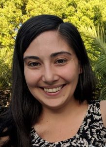
Job: Sr. GIS Analyst/Countywide Address Management Coordinator for the County of Los Angeles’ Internal Services Department on the Enterprise GIS (eGIS) team.Â
Bio: Rachel has been with Los Angeles County for 1 ½ years. Her previous engagements include Caltrans District 7, Clark County Water Reclamation & the Yurok Tribe. She has an undergraduate degree from Humboldt State University (’09), a Master’s Degree in Geographic Information Science and Technology from University of Southern California’s Spatial Sciences Institute (’15). She has certificate courses in Emergency Management from Western Washington University. Rachel is a Certified GIS Professional from the GIS Certification Institute and a Hazus Trained Practitioner from FEMA’s Emergency Management Institute, she is also currently working on obtaining her Project Management Professional certification from the Project Management Institute. Â
Rachel is actively involved in URISA and CGIA Professional Organizations. For URISA International, Rachel is Chairing the Vanguard Cabinet of Young Professionals group, she also is a member of the Next Generation 9-1-1 Taskforce and a half dozen other committees and workgroups. URISA’s Local Chapter, SoCAL URISA, Rachel is serving in a Young Professional Advisory role. Within CGIA, Rachel is on the Board of Directors as the Professional Society liaison. Rachel has been a ‘fly-on-the-wall at the FGDC Address Theme Subcommittee meetings for the past year. Rachel is also contemplating joining more workgroups and organizations, such as the California GIS Council and the National States Geographic Information Council in order to fully understand the state of Geospatial across the nation, through the lenses of Addressing and Emergency Management. Â
Current Projects: As Countywide Address Management System (CAMS) Coordinator for Los Angeles County, Rachel has the opportunity to modernize a decade-old system, building and developing the technical geospatial mechanisms and relationships with all 88 Cities within the Los Angeles County jurisdiction. The intergovernmental collaboration is just the beginning, building partnerships with the private sector and non-governmental organizations will foster the development of a coordinated system that provide authoritative (read: accurate) address information to all peoples within Los Angeles County.      Â
Rachel is currently serving as Co-Chair of the California’s Next Generation 911 GIS Taskforce (chartered in Feb. 2019), under the auspices of the State of California’s 9-1-1 Advisory Board, its Long-Range Planning Committee (LRPC). The Taskforce is working with CalOES’ 9-1-1 Branch on the State’s Plan for upgrading California’s 9-1-1 System to Next Generation 9-1-1 (NG9-1-1) with a focus of coordinating GIS efforts and implementing a Statewide NG9-1-1 Address Repository. Developing best practices and standards for programs like CAMS is one of the objectives of the NG9-1-1 GIS Tack Force in order to ensure that geospatial address information is used in conjunction with emergency service boundaries to determine the appropriate public safety answering point jurisdiction in order to receive the 9-1-1 call. Because when making 9-1-1 calls… “Seconds matterâ€.Â
Any fun things in your workspace? Rachel’s most ‘interesting’ item in her cubicle is an ironic poster of the “Gleason’s ‘New Standard Map of the World’â€, but she is disappointed no one has yet pointed it out. Another items of note would be an USB device of a model Trimble Geo Explorer series GPS Unit. Rachel was ‘over-the-moon’ when she found that she had access to a commercial grade ice maker at work.      Â
Anything about yourself?  Rachel is the stressed out mother of the original #GISBaby, Evha and a Pomsky named Hurley. They spend their time traveling and exploring places and oddities with Rachel’s husband-to-be, who shares her affinity for the craft of beer drinking. You can find Rachel on LinkedIn (www.linkedin.com/in/rachelrrodriguez). You can find out more about Rachel’s Projects at the Los Angeles County Enterprise GIS website. (https://egis3.lacounty.gov/eGIS/) under the tab of ‘COUNTY PROJECTS’.  Â

