Advancement of Collaboration Award
Granted for outstanding application of GIS technology representing innovative, elegant, or creative techniques. The technology may be transparent to the end user and is not required to display map output.
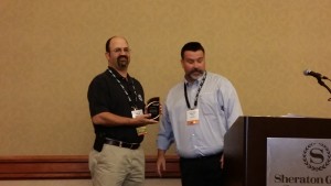
Winner: Dr. Steven Steinberg, SCCWRP
Dr. Steven Steinberg, a Principal Scientist at the Southern California Coastal Water Research Project (SCCWRP), leads a collaborative geospatial visualization project with the Tijuana River National Estuarine Research Reserve in partnership with scientists and managers from the Southern California Wetlands Recovery Project, San Francisco Estuary Institute (SFEI), Sacramento State University Center for Collaborative Policy (CCP), Esri, and University of Redlands MS GIS Program. This is developing 3-D visualization for Tijuana River National Estuarine Research Reserve.
This geospatial visualization, part of a comprehensive project funded through the National Estuarine Research Reserve System Science Collaborative, leverages emerging 3D visualization tools in assessing both the historical and future potential characteristics of the Tijuana River Estuary. To develop collaboration around the visualization component, Dr. Steinberg brought together a highly capable team of geospatial and scientific experts from agency, academic and private sectors. The result is an interactive platform to visualize the history and future of the estuary, considering a variety of potential scenarios for scientists and estuary managers.
Environmental data dating back to the late 1800’s compiled by the Historical Ecology Program at SFEI was combined with contemporary information and modeled future data based on SLAMM (Sea Level Affecting Marshes Model) to develop the visualization. Coupled with site-level elevation data and highly realistic vegetation models, the visualization provides the ability to interactively move through the landscape from any perspective or location, to assess past, present and future conditions in the estuary. The visualization tool serves as a model for other wetlands and estuaries.
Nominated by: Jeff Crooks
Chair's Award
Granted to honor a person who has made outstanding contributions in the promotion, innovation, and/or use of GIS technology. The recipient should show continued, exemplary contributions over the course of a prolonged period of time.
Winner: David Peck, Pictometry
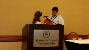
Dave Peck is the current chair of CGIA and this is his second time around as chair on the executive board.  He was instrumental in getting CGIA as a host of the CalGIS conference during his first term as Chair.  He has worked diligently in filling vacant positions on the board as well as inspiring new GIS professionals to join the organization.  He is also a member of several GIS groups around the state including Inland Empire, Orange County, and LA Geospatial as well as the Los Angeles Imagery Acquisition Consortium (LARIAC).  He participates in CGIA hosted events such as the GeoSummit at UC Merced where he has supported the event as a speaker as well as promoting GIS professional organizations like CGIA and the URISA Chapters.  He is often asked to speak at other conferences and is always willing to share the benefits of GIS.  Dave works tirelessly promoting and supporting GIS efforts and the GIS community and is deserving of the Chairman’s Award.
Nominated by: RuthAnne Harbison
Excellence in Education Award
Granted to the educational institution that displays extraordinary approach, contribution, development or commitment to GIS education in California.
Winner: Dan Scollon, Shasta College
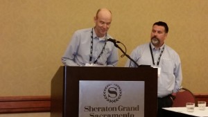
Dan Scollon has been an instructor of GIS, Geography, and Natural Resources at Shasta College since 1996. He has developed the program and has reached many hundreds of students – a number of them have since been very successful in the local area as GIS professionals. Dan has a commitment to his students, whether in class, developing meaningful worksite learning opportunities or in providing and promoting employment opportunites that fit their skill sets. His focus has been with Community Engagement directing many student projects to helping better meet the needs of the community.
According to a student of Dan’s, he is knowledgeable, articulate, and energetic. Several students have switched majors to Geography after taking his classes – a testament to his enthusiasm for the subject.
Dan is a Founding member of The Borneo Project since 1994, and continues to advise the Project on community resource mapping helping to chart a new future for the people of Borneo.
He was a speaker in at TedxRedding 2013 articulating the role of maps throughout history and their development in today’s society and uses of the digital map.
Always an advocate for the profession Dan was instrumental in the development of the Far North Regional GIS Council (FNRGC) and the Redding Area GIS User group (RAGU), both successful organizations that promote GIS and are open to any professional, student and interested person. Dan is a principle sponsor of FarNorCalGIS.org a platform for sharing geospatial data and resources.
Nominated by: Terri Webster
Exemplary Systems Award
Granted for outstanding application of GIS technology representing innovative, elegant, or creative techniques. The technology may be transparent to the end user and is not required to display map output.
Culvert Inspection Program
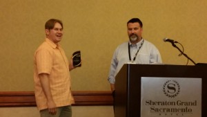
Winners: Tim Jankowski and Robert Shanaberger, Caltrans - District 11
The Caltrans District 11 Culvert Inspection Program (CIP) has saved almost $300 per culvert inspection since it incorporated GIS into their workflow.
The CIP is a statewide initiative to locate, assess, and rehabilitate drainage culverts within the state highway system’s right of way. Because many culverts are exceeding their fifty-year lifespan, Caltrans mitigates the increased risk of culvert failure through regular inspections and proactively repairing culverts prior to flood events.
The District 11 CIP team collaborates with the GIS team to utilize GIS technology throughout the program. Scanned as-builts were georeferenced, mosaicked, and published as an image service using ArcGIS for Server. The as-builts image service is used to locate culvert storm drain locations prior to field inspection, thus decreasing time spent in the field.
Once in the field, GPS units are used improve positional accuracy of storm drains and store their inspection assessment rating. Back in the office, the data are post-processed, loaded into a geodatabase, and published as a Web Map Service. This service and other related data are used in the Culvert Inspection Program Viewer – an online map using the ArcGIS Viewer for Flex.
District 11’s CIP has become one of the highest performing programs in the state. Between 2005 and 2011 the program was run by consultants; almost 5,000 culverts were inspected at a cost of $423 per culvert. In 2011, the program was taken in-house and integrated with GIS technologies. Between 2011 and 2013, over 4,700 culverts were inspected costing only $133 per culvert.
Nominator: Barbara Kent
Outstanding Internet Application Award
Granted to the outstanding integration of GIS and web technologies demonstrating excellence in aesthetic presentation, functionality, ease of use, and overall user experience.
Pest Detection Viewer
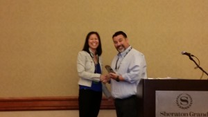
Winners: Tom Weisenberger, Max Regis, and Christine Lam
Detecting invasive insects is extremely important to protect California agriculture. A web mapping and editing application with mobile capabilities has been developed, called the Pest Detection Viewer, at Los Angeles County so that paper files stored in binders can be converted into a GIS database. We had to simplify the interface and functionality of the viewer to allow temporary workers with no GIS skills to enter data seamlessly into the application. The back end programming is where all the magic happens – spatial triggers allowed information from other layers to be detected and filled in to the current database in order to eliminate additional field entries for the temporary workers. In just six months, over half a million fruit trees, trapping notes, and parcel characteristics have been entered into the database. The application allows inspectors to (1) more efficiently plan their inspection routes ahead of time, (2) arrive at the precise coordinates of the traps, (3) edit any trapping/inspection information in the field, and (4) take photos of the current trap site. The Viewer was built with minimal costs using Latitude Geographics’ Geocortex platform and constantly integrating user experience to enhance the application. The developers of the application presented to the California Department in Food and Agriculture in February 2015 to showcase the application as well as the progress that LA County has made.
Nominator: Christine Lam

Pingback: 2015 CGIA Awards announced at CalGIS 2015 | California Geographic Information Association
Pingback: Temporal Investigations of Marsh Ecosystems (TIME) — Tijuana Estuary : TRNERR