 Passing this information along from Drew Decker of the USGS:
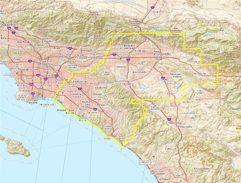
USGS has now posted 2014 imagery for a portion of the southern California urban region. New imagery was collected in mid 2014 by USGS contractors for the built up areas around the Orange County and Riverside/San Bernardino urban areas. This region covers about 2,250 square miles. The images have a one foot resolution and are in natural color. The image tiles can be downloaded from the USGS EarthExplorer site here: earthexplorer.usgs.gov
The image to the right shows the project footprint. Please let me know if you have any questions. Thanks,
Drew